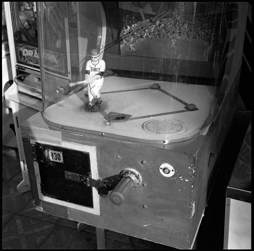
 The Japanese love baseball, or, as they call it, yakyu. The Tokyo Giants are the defacto national team. This vending machine was found on En-no-shima, a small island south of Tokyo near Kamakura. Click on the image for a larger view.
Category Archives: Japan
Pilgrim
 Pilgrims flock to the island of Shikoku in Japan. Through the centuries, the fundamental practice of these pilgrims has not changed: they walk, they pray. To complete the entire route, a little over 1,200km or 750 miles, takes most travelers about fifty days. Some have claimed do this in thirty—a formidable feat. The path is mostly on roads. It hugs the coast and crosses mountains.
One hundred years ago, the average pilgrim is said to have spent about one hundred days to complete the pilgrimage. Roads, general health, and modern gear are mostly responsible in changing that. I am grateful of not having to wear the traditional straw sandals and cotton robes, which must have made this journey even harder.  This pair of pilgrims from the early 20th century are described as monks, but wrongly cited as carrying statues of the Buddha—the image on their backs is of Kobo Daishi. The photograph is from the book By Nippon’s Lotus Ponds; Pen Pictures of Real Japan by Matthias Klein and published in 1914. Click on the images for a larger view.
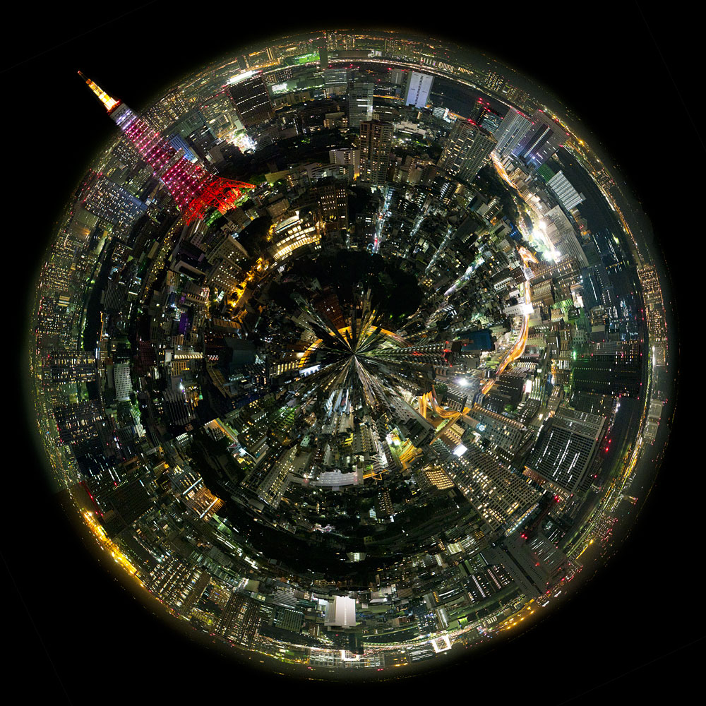
Planet Tokyo
Shugyo Daishi and the Pilgrim
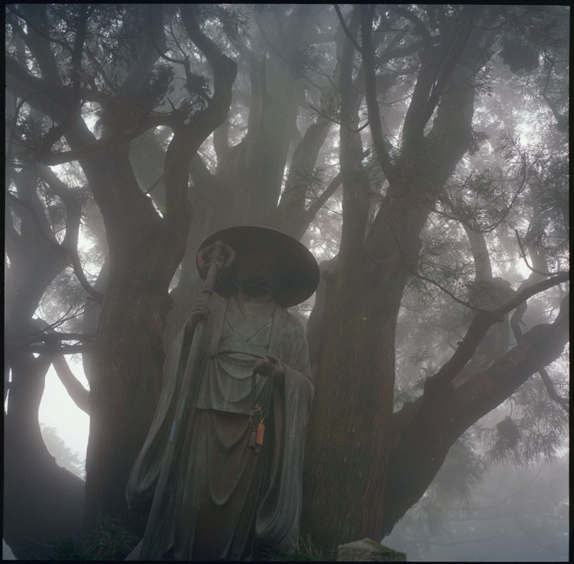 The trail between temples 11 and 12 was enveloped in fog the day we travelled it. The mountain path followed a forested ridge. Then, strangely, the dirt trail ended in a flight of stone steps. As we climbed, a figure materialized from the trees.
We had reached Jyouren hermitage, a bangai, an unnumbered temple, one of over a hundred such places on the 88 Sacred Places of Shikoku Pilgrimage. The statue is of Shugyo Daishi. This is not the image of Kobo Daishi, the saint pilgrims follow and the one that attained enlightenment, but the man that was seeking that enlightenment.
The tree behind the statue was said to have been planted by Kobo Daishi when, in a dream, he had a vision of the Buddha Dainishi-nyorai. Click on the image for a larger view.
On the Streets of Tokyo—Ameyoko
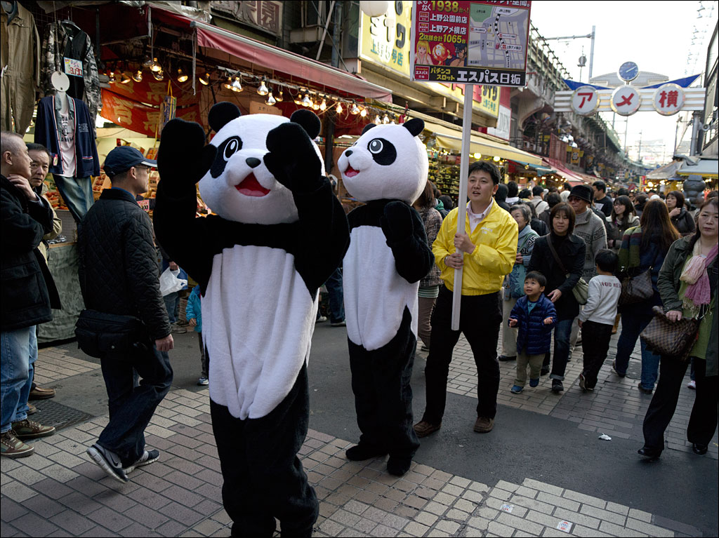 Ameyoko is an energetic market town. Vendors have built a warren of shops and stalls under the elevated railway cutting through the city. Unfortunately, this magical part of Tokyo is under threat of development.
The pandas you see are part of an advertising campaign. You might be forgiven to think they are promoting a new toy store or the nearby Ueno zoo, especially with the excited young boy following them. What they are announcing is a pachinko parlor. Pachinko is a type of vertical pinball machine used in gambling. Click on the image for a larger view.
On the Streets of Tokyo—Shinjuku
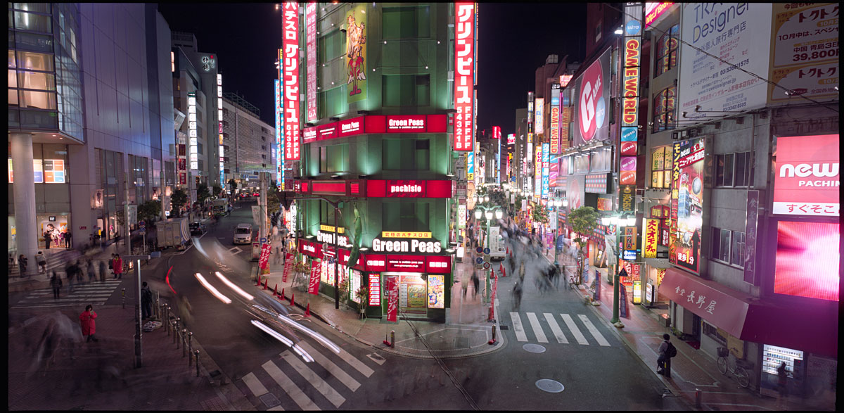
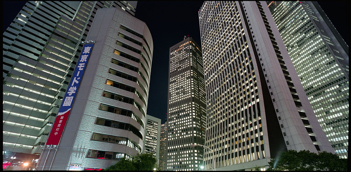 Shinjuku is a major center in Tokyo. Many western cities usually have one large center. Tokyo has a large number of active hubs spread like islands throughout an ocean of residential neighborhoods. West Shinjuku is the location for the metropolitan government and a forest of skyscrapers. Much of the rest of Shinjuku is given over to shopping and entertainment. Click on the images for a larger view.
Passport to Enlightenment
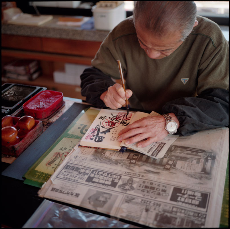 The pilgrim to the Eighty-eight Sacred Places of Shikoku Pilgrimage carries a small book, nokyocho, in which the seal of each of the temples is inscribed, in this case, temple 84. It is one of the most important records of the journey and is treasured as a sacred object. If the pilgrim undertakes another pilgrimage, the same book is used with a new seal being inscribed over the previous ones. Pilgrims that have completed the path multiple times have pages covered red and black from the number of inscriptions. Click on the image for a larger view.
Kamikochi and Yari-ga-take
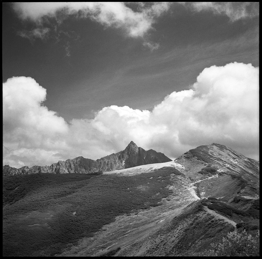 One of the most popular climbing destinations in Kamikochi is the arrow-shaped peak of Yari-ga-take (3,180m/10,430ft.). And it is popular. You will most likely have to stand in line during the morning rush hour while climbers ascend to the summit—there are two routes, one to go up and another to go down.
The first known ascent of Yari-ga-take was by the Buddhist monk Banryu in 1826. The English missionary Walter Weston would scale this mountain 66 years later. While Banryu installed three Buddhist statues, today the summit has a Shinto shrine. The cave Banryu was said to have used for his attempt is still on the trail a few hundred meters below the ridge.
This image was taken from the trail to Momisawa-dake (2755m/9,040ft.) north of Kamikochi. This is a gentler, more secluded section of the alps. Click on the image for a larger view.
Kamikochi and Daikiretto
 The main ridge of the peaks in Kamikochi is a spectacular alpine zone. Daikiretto (大切戸), the Big Gap, is a one kilometer or two-thirds of a mile section that has numerous vertical pitches of rock with chains and ladders to aid climbers. The estimated time to traverse this for an experienced climber is about three and a half hours. This is the view from Kita Hodaka-dake (3,106m/10,190ft.). Click on the image for a larger view.
Kamikochi and Yoko Valley
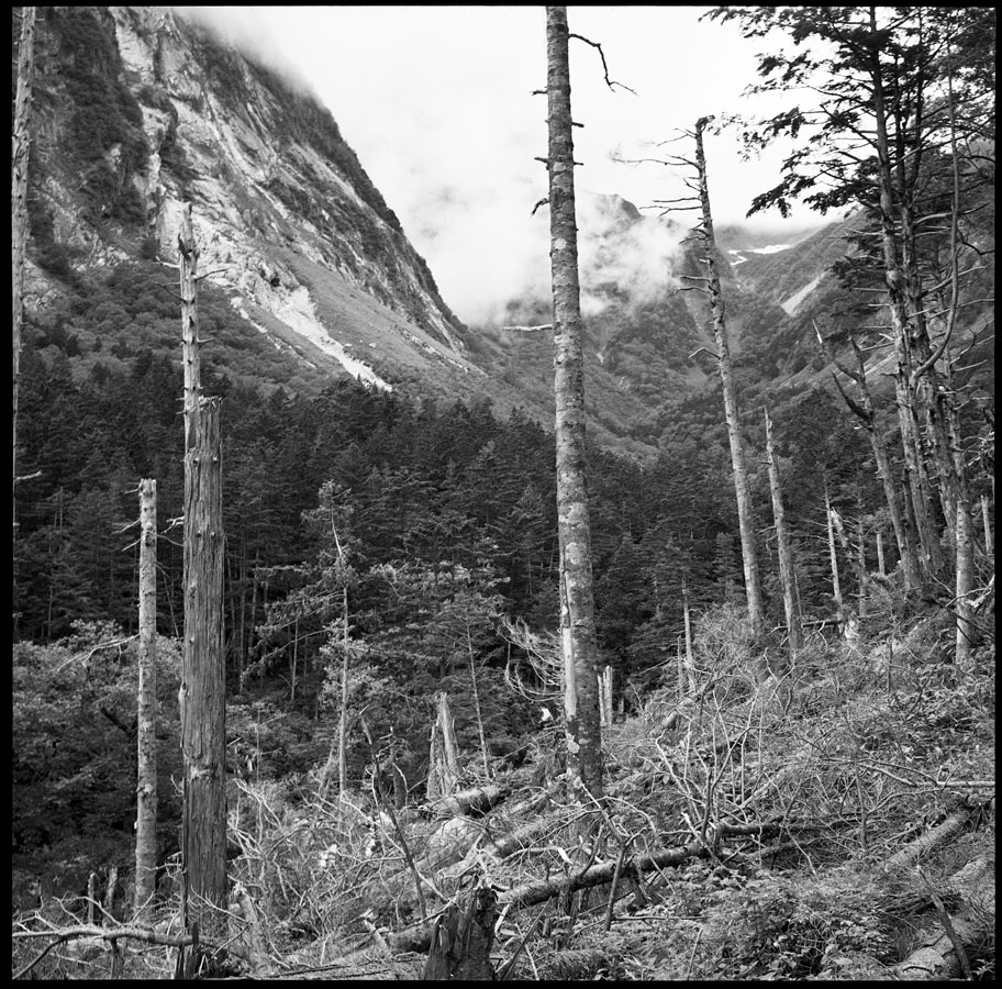 The summer climbing season, coming between rainy season in June and typhoon season in August, is a short one. It is said the last ten days in July present the most stable weather. Even in the best of weather, you can be almost guaranteed a shower in the mountains in the middle of the day, even if the rest of the country is seeing blue skies and sunshine.
One of the most popular routes to the summit of Okuhodaka-dake is through Yoko valley. With a wet, temperate climate, the tree line in the Japanese Alps is around 2,500m/8,200ft. Click on the image for a larger view.

